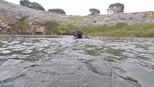
THE surface water is green and murky, but as I descend it becomes somewhat clearer and before long the wreck of a truck becomes visible – one of four vehicles dumped in the sinkhole.
It is the cabin of an old International truck that has found a final resting place at a depth of around 10 metres.
In addition to the truck, divers have discovered a Morris Minor ute, Austin car and a fourth unidentified vehicle over the years.
Located a short drive from the region’s famous Kilsby’s Sinkhole, The Sisters comprise two almost intersecting sinkholes with a dry limestone strip or saddle between them.
The saddle is around 15 metres wide and three metres high and separates a northern and southern hole.
The holes are almost mirror images of each other with lakes spanning 40 metres across and featuring vertical cliffs that drop nine metres to the water’s surface.
The southern hole contains the wrecks and other rubbish while its northern counterpart has been left remarkably unpolluted.
Underwater, the mud-floored lakes descend under the cliffs into dark roof overhangs reaching maximum depths of around 20 metres.
Veteran cave diver and Cave Divers Association of Australia life member Peter “Puddles” Horne described the holes as a “geological rarity, even in such prominent cave-country as the Lower South East”.
“The Sisters were most likely formed from two end-collapses of a single large cavern,” he said.
“The vertical cliff faces are decorated with many unusual keyhole shaped solution holes and bulbous stromatolic growths.”
His words were echoed by CDAA science officer Ian Lewis, who said only two other double sinkholes are found in Australia.
They are on the Nullarbor Plain in similar limestone, but are dry.
“The saddle is solid rock – not a pile of broken boulders – which means an underwater tunnel between the two lakes is a possibility,” Mr Lewis said.
“Perhaps in time the lakes will become a large circular sinkhole like the others in the region.”
Mr Lewis said divers have found remarkable pieces of historical rubbish in the lakes.
“Years ago divers discovered a case of old dynamite in the southern hole which was removed very carefully,” he said.
“There is also a wooden butter churn the size of a barrel under the southern wall which may be a century old.
“Interestingly a Moloney’s lemonade bottle from the original company in Commercial Street West more than 60 years ago was recovered from the mud.”
The earliest European record of the sinkholes was made by Governor George Grey’s expedition in May 1844, when he named them “Double Well”.
The expedition came from Adelaide to the South East and explored the region across the Kongorong Plain, heading towards Mount Schank.
Mount Schank Station was the first large property being cleared at that time and the expedition was heading for the homestead on the east side of the mountain when they encountered the sinkholes.
Mr Lewis said sinkholes in the region were “wonderful sources of water for the stock of early settlers” and The Sisters have a small ramp cut into the central limestone ridge to allow stock to reach the water.
“By the style and scale of the ramp, it is very likely the first of its kind cut into a sinkhole in the region – maybe as early as the 1850s,” he said.
“It was followed later around the 1880s to 1900 by much bigger ramps to get into deeper sinkholes like the nearby Little Blue Lake and One Tree Sinkhole.
“Between The Sisters and Little Blue Lake are some very old cart tracks and a carved sheep wash ditch cut into the limestone which are listed under state heritage as the Mount Salt Limestone Track – an example of very early stock handling and connection between watering sites before all the land was cleared.”